
Update Overview
Rendering
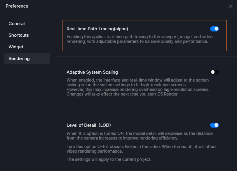
- Real-time Path Tracing (alpha)
- Night Sky: Moon, Stars, Milky Way
- Optimized Snow and Rain Effects
New and Optimizations
- City Generator with OpenStreetMap Integration and Shapefile Import Support
- Added AI Inpainting and Motion Blur to Post-Ai
- Optimized AI Enhancer and AI Style Transfer
- Optimized AI Make Seamless
- Optimized Terrain Tool with Range Settings and Optimized Erosion Layer
- Optimized D5 Scatter Workflow
- Optimized Direction Controller for Fly in/out Animation Templates
- Supports Setting Default Display Unit for Model Position and Size
- Auto-save of Render Queue before Cancelling Rendering
- Batch Deletion in Scene List
- Added French and Japanese Language Options
- Supports DLSS 4
D5 for Teams
- OneDrive and SharePoint Integration
- Supports Setting Brand Watermarks
- Optimized the Animation Effect of 3D Dollhouse
Assets
- Hotel & Resort Models
- New Scatter Templates
Fixes
- Incorrect rendering of orthographic views
- Blurry texture maps when FPS Booster for Complex Geometry is enabled
- Terrain flickers when switching painting textures with FPS Booster for Complex Geometry enabled
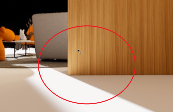
- Blurry custom Multimedia material maps after re-opening the scene
- Display issues with the Normal map of glass materials generated from the base color map
- Ineffective scattering color of water materials
- Incorrect individual UV of water materials from D5 Asset Library
- Lost Individual UV option of emissive maps when setting custom materials
- Changed procedurally-generated vines after re-opening the scene file
- Inability to select all the path nodes
- Missing target areas when generating scatter
- Inability to paint coherently on terrain when using the Brush tool
- Loss of terrains after re-opening the scene when the Windows username has invalid characters
- Operational issues with D5 caused by GPT Chrome browser
- Incorrect plant icons in the scene list of previous archives
- Flickering issue with cars dropping to the ground when rotating the camera or clicking in the scene
- Inability to recognize virtual tour links with “&” in their filenames
- Misclassification of plants as “Other Models” when merging projects
- Occasional inability to play batch-rendered .mp4 videos
- Occasional inability to open scene files containing procedurally-generated vines
- Insufficient video memory when re-opening scene files with lots of assets
- Material selections stuck in scene files stored in NAS
- Loss of scatter settings when scatter surfaces disappear
Detailed introduction to some features
Rendering
1. Real-time Path Tracing (alpha)
-
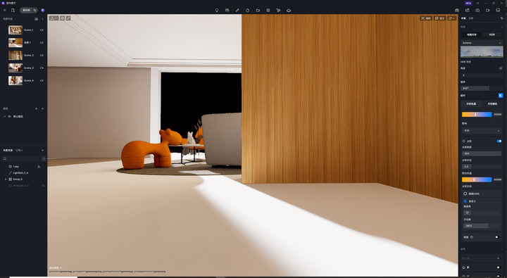
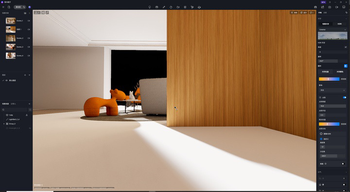
Enabling the Real-time Path Tracing option from Preference > Rendering will apply the real-time path tracing GI to the viewport, image, and video rendering. Disabling this option will revert the GI solution to the one used in version 2.9.
-
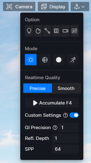
Added Accumulate mode and relevant Custom Settings to Display > Precise Realtime Quality. Custom settings affect the accumulate mode and image & video renderings.
-
Accumulate: When enabled, pixel samples will be accumulated until the real-time preview quality reaches the final output. Moving the camera or pressing the ESC button will terminate the process.
-
Custom Settings:
- GI Precision: Includes three precision levels. The lower the level, the faster the accumulation; the higher the level, the more precise the GI quality. Note that the GI for reflections is also influenced by this setting.
- Refl. Depth: Controls the number of times rays bounce between highly reflective material surfaces.
- SPP: Determines the number of times each pixel is sampled. Increasing the value helps optimize artifacts in challenging areas and enhance details but will also increase the rendering time.
-
Note
- When custom settings are enabled, they will be applied to the accumulation. Otherwise, it’s set by default to GI Precision at 1, Reflection Depth at 2, and SPP at 64.
-
-
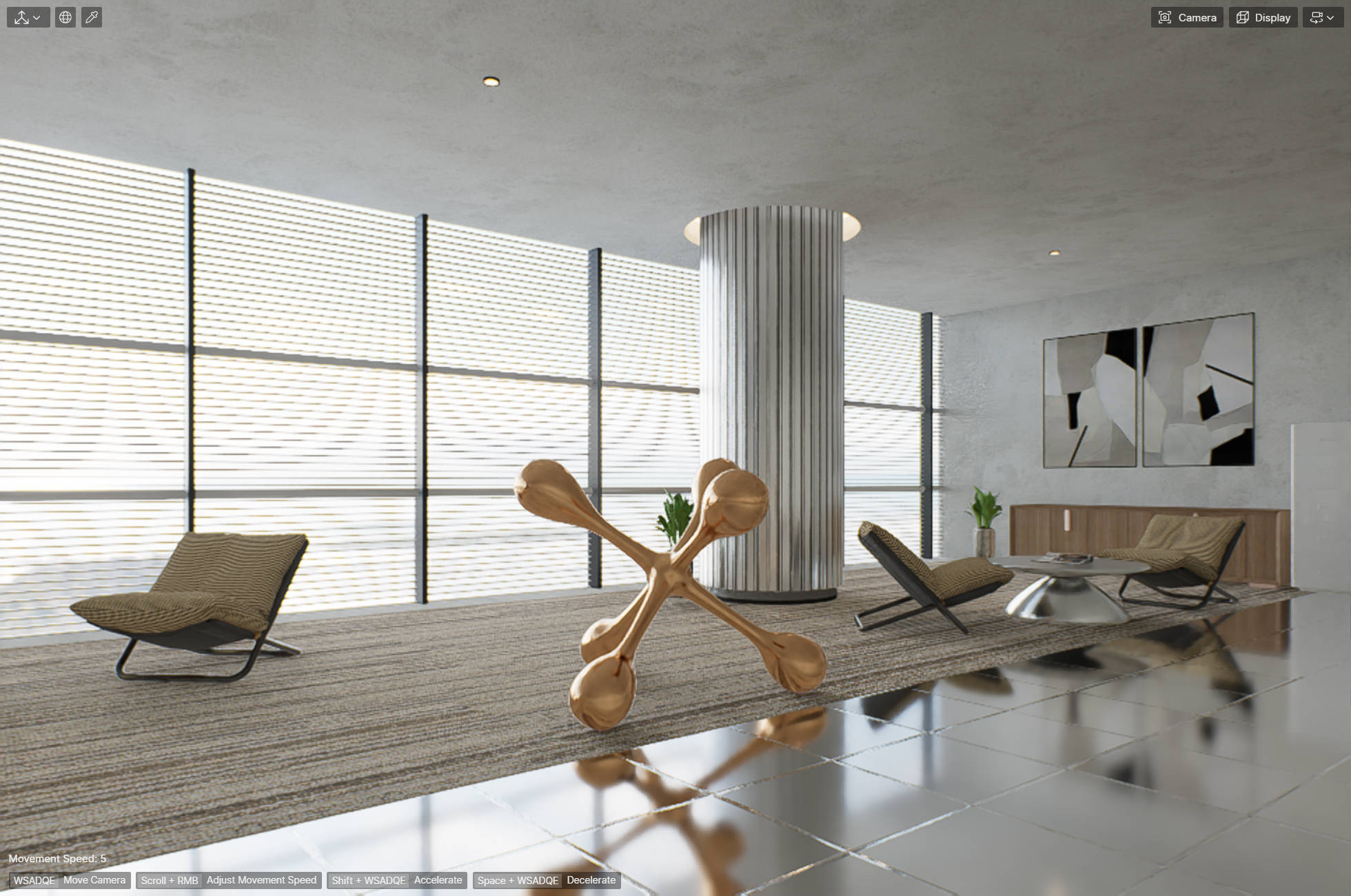
Major changes in the new GI
-
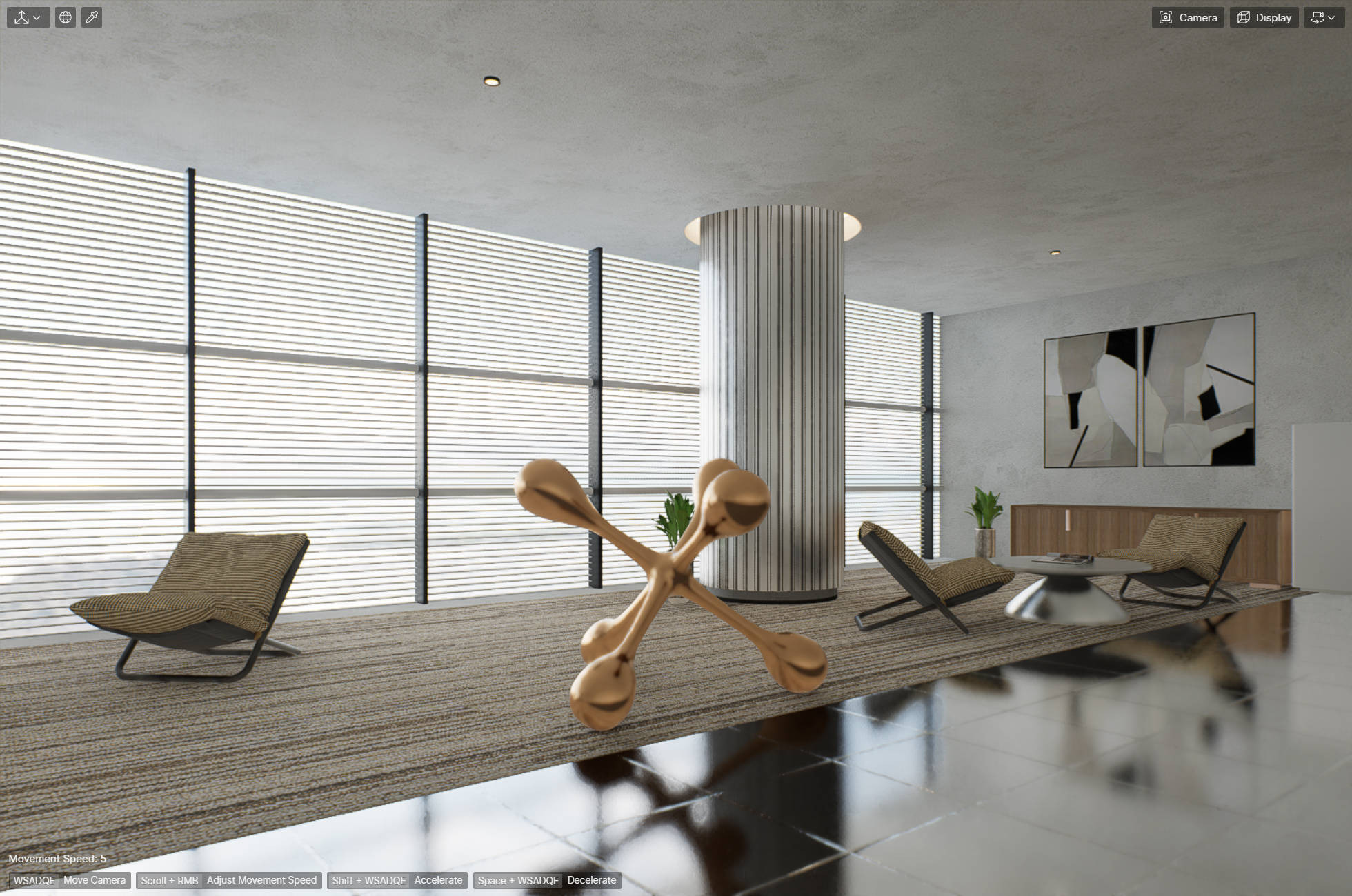
Improved GI Caching: The new GI solution has improved both quality and precision. It utilizes path tracing to calculate and cache ray bounces before rendering begins, thereby improving caching quality. For example, the D5 2.9 viewport struggled to accurately display reflections on this highly reflective floor, leading to darker areas. However, this issue has been resolved in the D5 2.10 viewport.
-
Optimized GI bouncing details: GI bouncing details are more accurate in areas like the joint where the wall meets the floor.
-
Unbiased sampling and visibility detection: The sampling logic has been optimized to sample more important pixels in a more efficient way. This makes indirect lighting details closer to the Ground Truth.
-
Optimized plant and fabric materials: Improved the color shading model for plant and fabric materials, fixing the color attenuation issue in light transmission, resulting in more physically accurate transmission effects. As a result of these improvements, the color of vegetation and their reflections may change if they were created using previous versions.
-
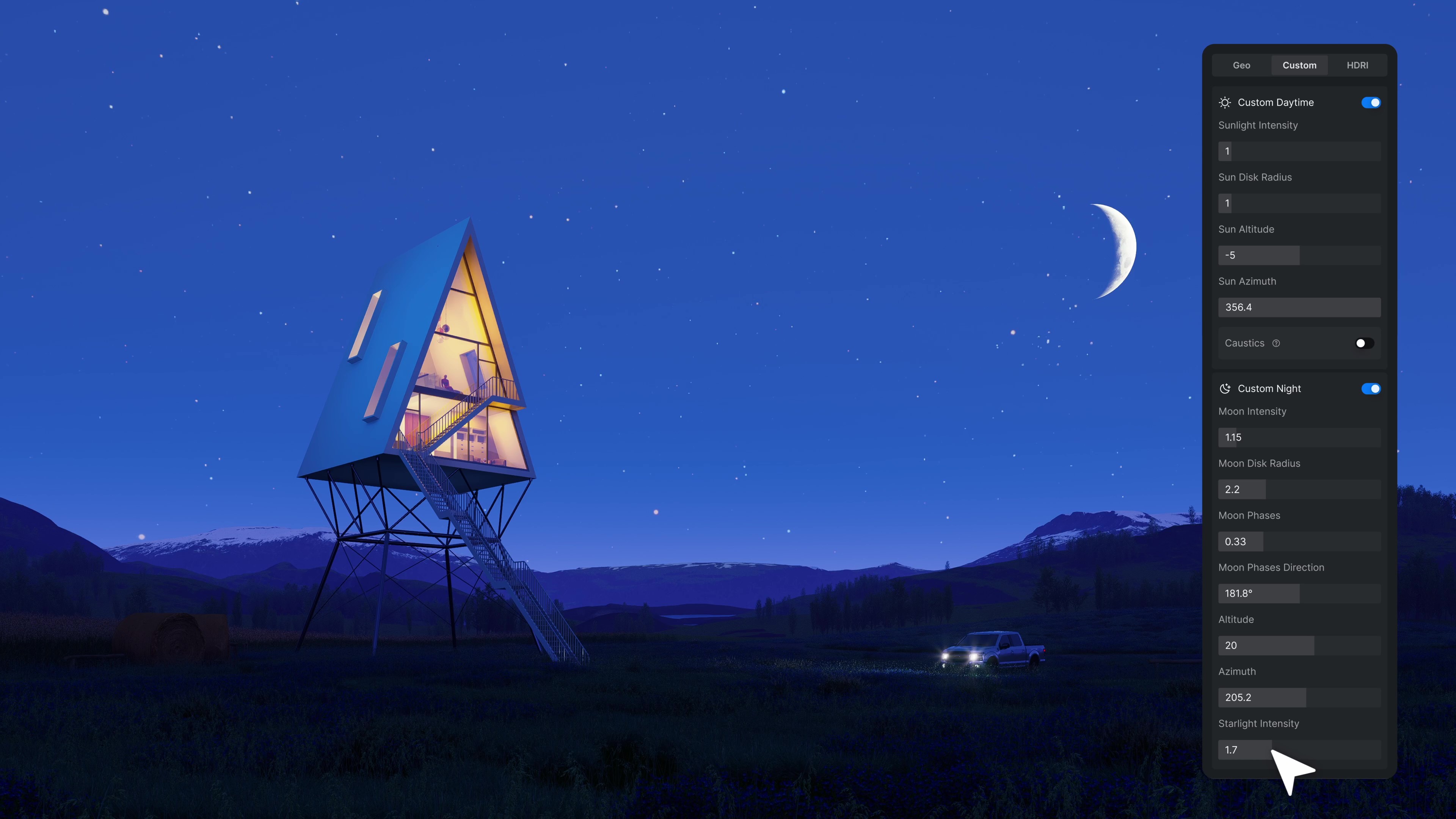
2. Night Sky: Moon, Stars, Milky Way
-
Day-Night Cycle in Geo Sky
- Added night sky to Geo Sky for effortless and realistic simulation of varying lighting conditions from dawn to sunset and night.
- Supports customization of sun/moon disk radius and sun/moon/star light intensity.
-
Custom Night Settings
- Added Custom Night to Environment > Custom.
- Supports customization of Moon Intensity, Moon Disk Radius, Moon position (Altitude and Azimuth), Moon Phase, and Starlight Intensity to achieve the desired nighttime environment.
-
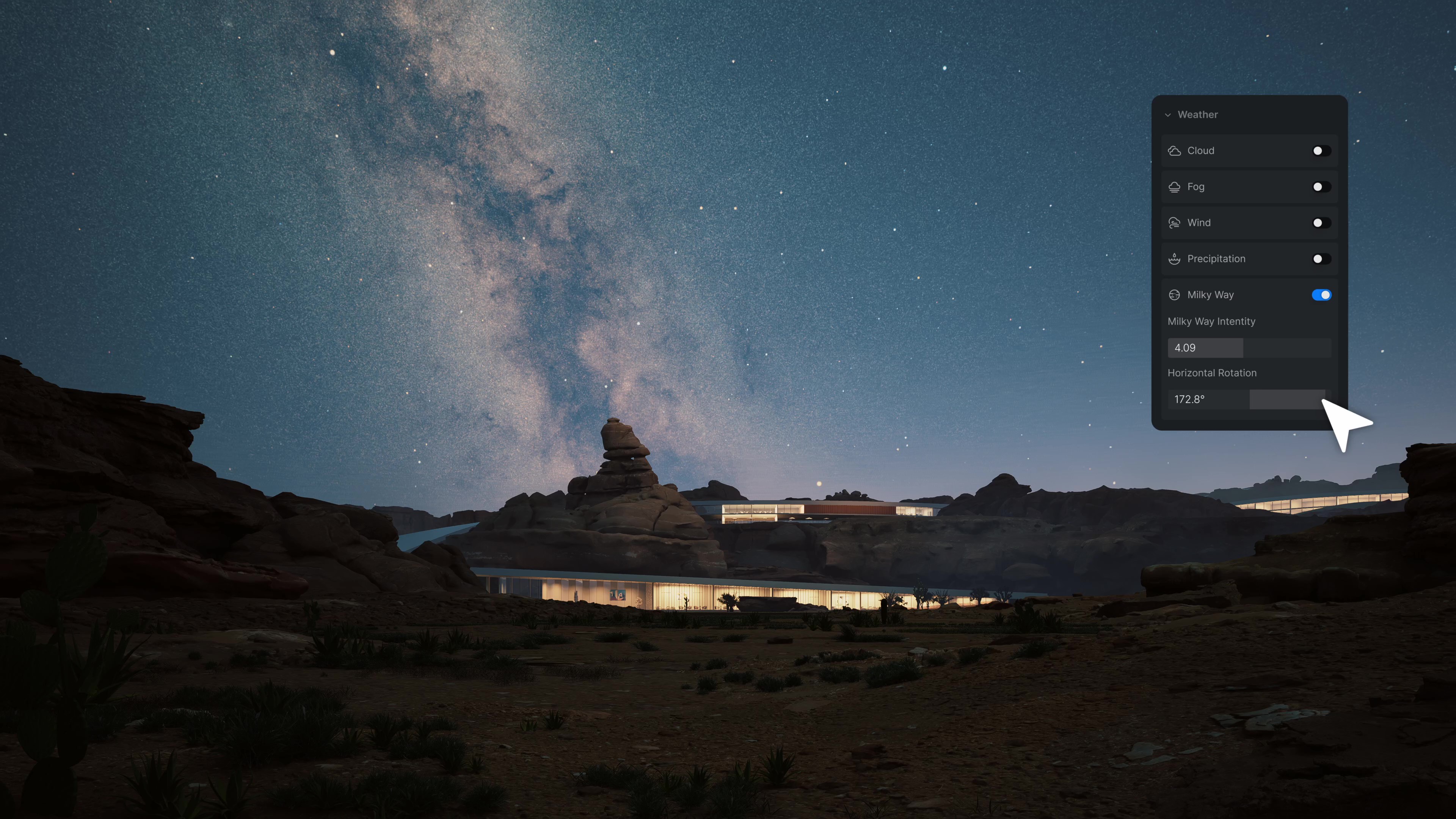
Milky Way
- Added Milky Way to Environment > Weather. When enabled, you can adjust its intensity and direction to enhance realism.
- Added Milky Way to Environment > Weather. When enabled, you can adjust its intensity and direction to enhance realism.
3. Optimized Rain and Snow Effects
-
Optimized the raindrop and snowflake effects, along with improved puddle and ripple.
-
Added the Water Mist option to simulate the humid rainy environment.
New and Optimizations
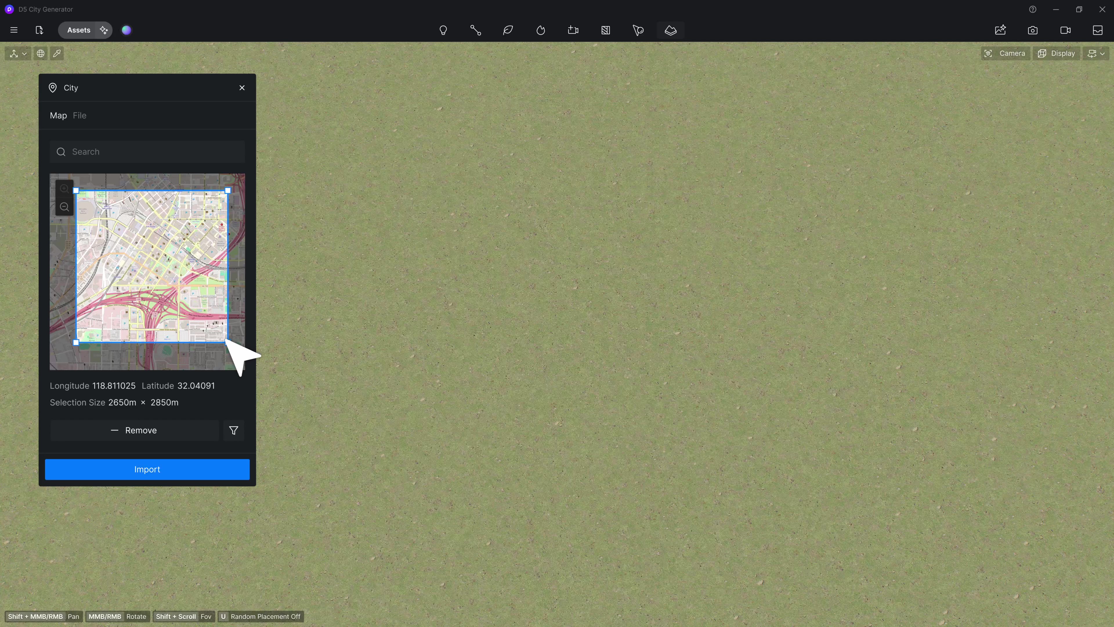
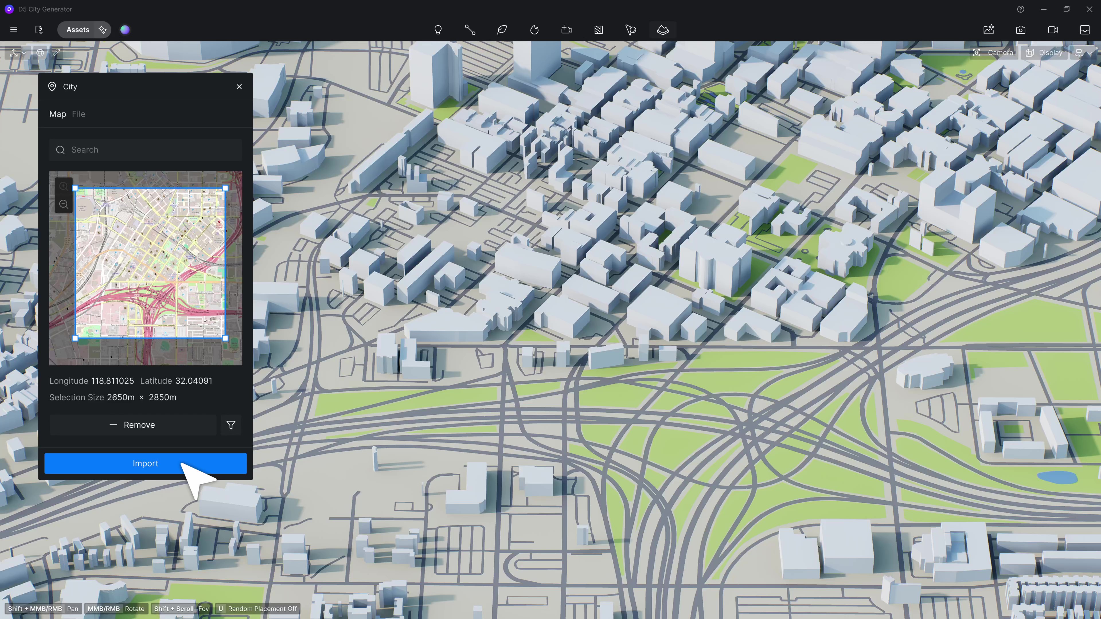
1. City Generator
- OSM Integration
Integrates the open source data from OpenStreetMap to automatically analyze and generate roads, buildings, terrain, and other topography features, enabling effortless site context creation.
*OSM (OpenStreetMap) file is a map data file based on the OpenStreetMap data. These files contain the topography information of roads, buildings, terrain, etc., and are widely used in map drawing and urban planning.
-
OSM Import
-
Added City to Terrain menu on the top toolbar. A window containing the map will pop up upon clicking on the City button.
-
Supports quick location of the target area by entering its name or moving the selection box. The area is restricted to 4km*4km.
-
Supports filtering and importing certain topography features such as buildings, roads, greenland, water, or satellite images.
-
-
City Model Management and Editing
-
After the import is complete, the map model will appear in the viewport, with its topography elements as a group within the object list.
-
Building Group Settings
- Overall Elevation: Supports concurrently adjusting the height of all buildings.
- Random Elevation: Supports setting random heights for different buildings.
- Individual Elevation
-
Road Group Settings
- Road Width: Supports setting the road width.
-
Material Settings
- Base Color and Base Color Map
- Opacity: Supports setting opacity for the building structures.
-
Supports showing/hiding the entire group or individual items within the group.
-
Items selected from the object list will be highlighted with strokes in the viewport, while buildings selected in the viewport will automatically be located within the object list.
-
City Group Deletion/Replacement
- Right-click on the city group in the object list to find the option to delete the entire group.
- Select the city group from the object list and there is an option of “Replace Source” in the relevant control panel, which enables selecting a new area.
-
-
Note
- For better performance and efficiency, it is recommended to choose a moderate area to prevent excessive processing time due to large areas.
- This feature requires online access to OSM data. Please ensure a stable Internet connection for smooth download and analysis of OSM data.
- Please enable the “FPS Booster for Complex Geometry” when flickers appear after importing the city model.
- Shapefile(.shp) Import
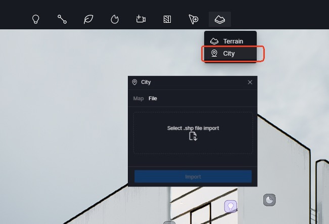
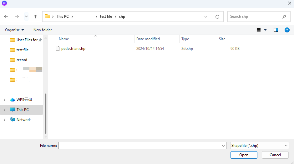
Supports Shapefile import for effortless site context creation.
*.shp file is ESRI Shapefile data format widely used in geographic information systems (GIS). It typically contains vector data, such as points, lines, and polygons to represent geographic features including buildings, roads, rivers, and administrative divisions.
-
.shp Import
-
Added City to Terrain menu on the top toolbar. Supports selecting multiple .shp files for batch import with an individual file size limit of 10 MB.
-
Note: Shapefile is usually composed of multiple files. Ensure that all related files are complete and placed in the same directory (select. shp file to automatically associate and read files with the same name in other formats in the same directory, such as. shp,. shx,. dbf)
-
D5 automatically analyzes the geographic information in the .shp file and generates corresponding 3D models.
-
Each imported file is stored as a group in the object list, containing three types of objects: “Buildings,” “Roads,” and “Undefined.” Supports repositioning or rotating the entire group.
-
-
Settings
-
Building Group and Undefined Group
- Supports adjusting overall and individual elevation and enabling random elevation for the group.
- Material base color, base color map, and opacity
-
Road Groupp
- Width
- Material base color and base color map
-
-
Note
-
Possible causes and solutions for parsing failure:
- D5 currently supports polygon and polyline data. Other data formats might fail to be analyzed.
- Shapefile typically contains .shp, .shx, .dbf, and many other files. Please select the main file .shp to import.
- Ensure that all related files (such as .shx and .dbf) are complete and placed in the same directory, so that D5 can automatically import them along with the .shp file.
-
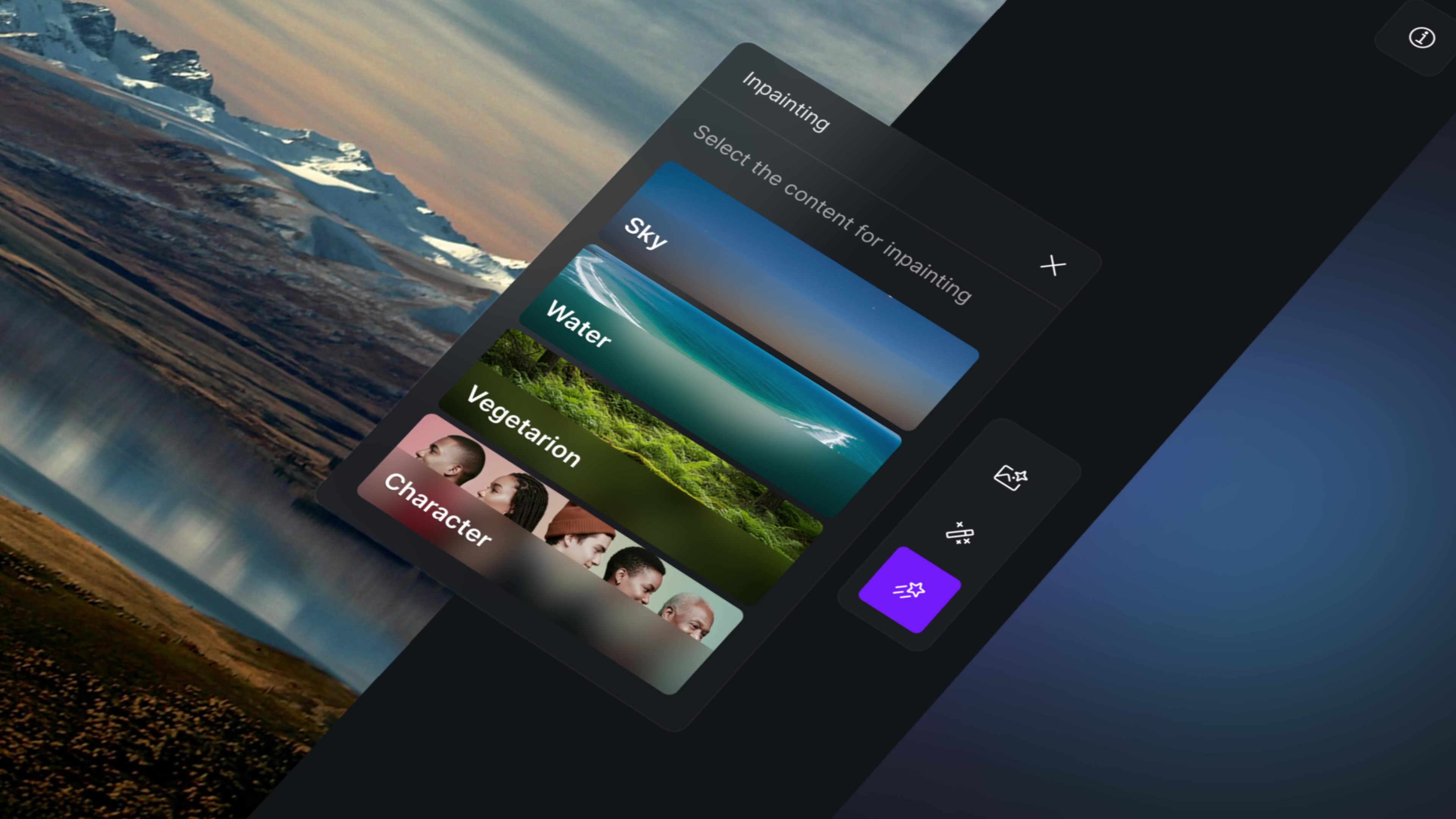
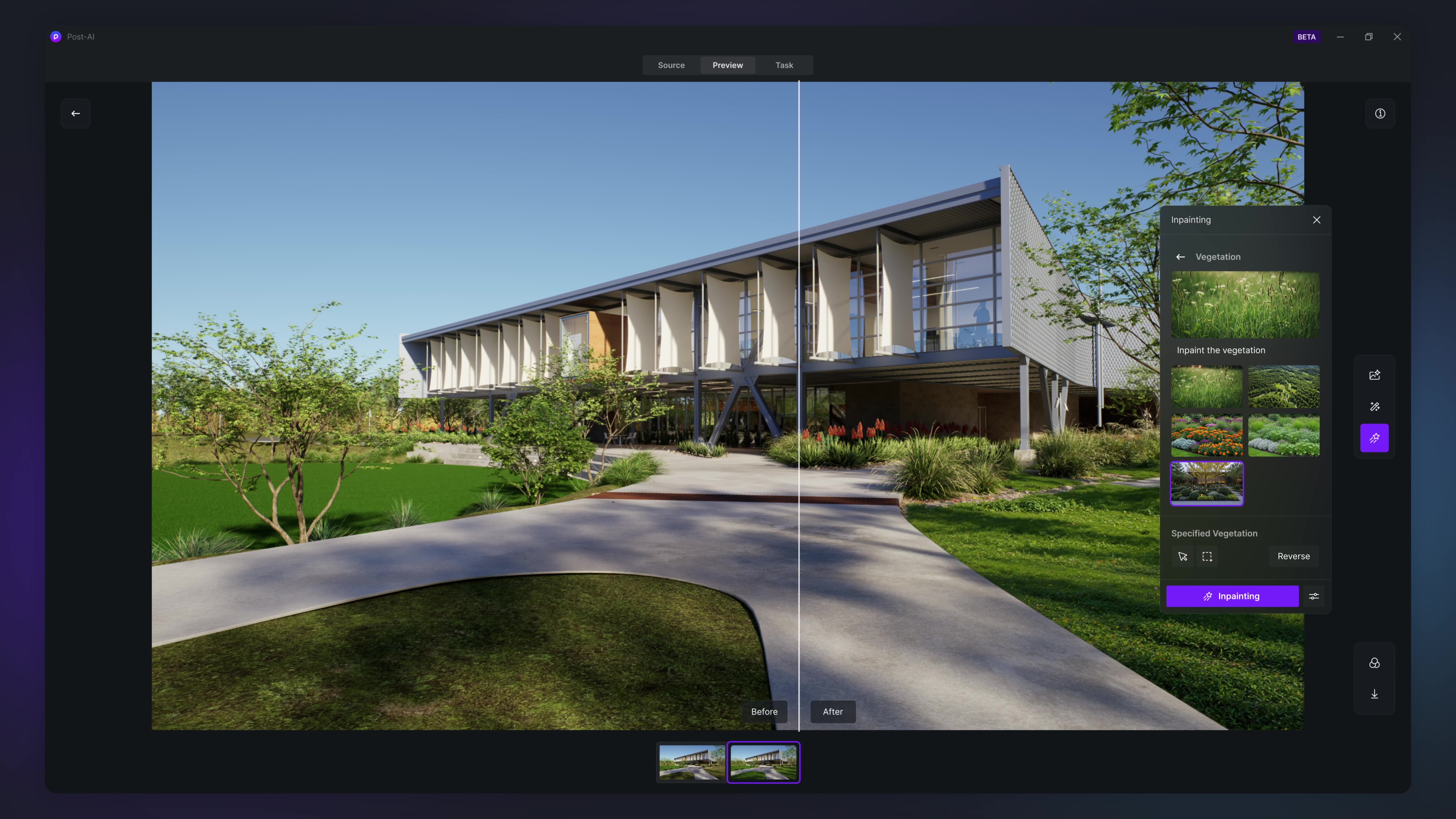
2. Post-AI: AI Inpainting, Motion Blur
-
Added new local inpainting feature to automatically recognize and inpaint sky, water, or vegetation for images rendered with AI Post channel.
-
Best practice: Leave specific areas, such as a flower garden, empty without the need for manual layout; AI will automatically populate them to enhance the visual appeal.
-
Inpaint the original image: Allows AI to intelligently inpaint based on the original image structure to align with the creative intention.
-
Note:
- D5 supports auto recognition for the Sky area. Water and vegetation areas require manual selection.
-
-
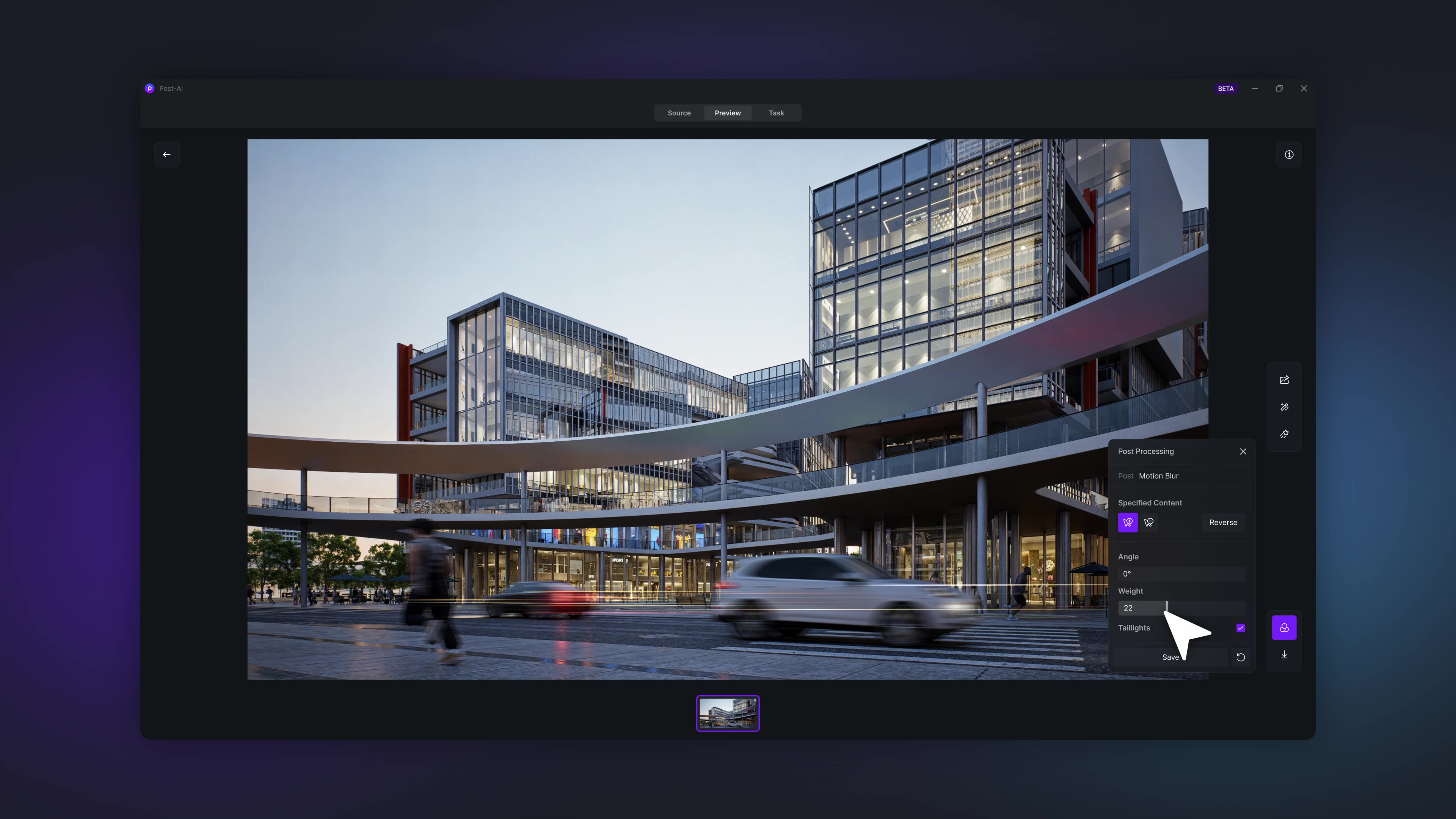
Supports adding Motion Blur to characters and vehicles with one click.
- Supports customization of angle and intensity.
- Supports setting taillights for vehicles.
3. Optimized AI Enhancer and AI Style Transfer
- Optimized AI Enhancer with better control over text and logos in the images.
- Optimized effects for the “Realistic” style of AI Style Transfer.
4. Optimized AI Make Seamless
- Optimized the algorithms of AI Make Seamless to more accurately detect material edges and seams for better seamless effect.
5. Optimized Terrain
-
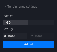
Supports setting terrain range and Z-axis position
-
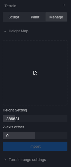
Added Terrain Range Settings to Terrain > Manage.
- Position: Determines the position of the boundless plane along the Z axis.
- Size: Determines the size of the editable terrain range. Smaller terrains take up less ram and vram.
-
Changing the terrain size will affect the painted materials and heights.
-
-
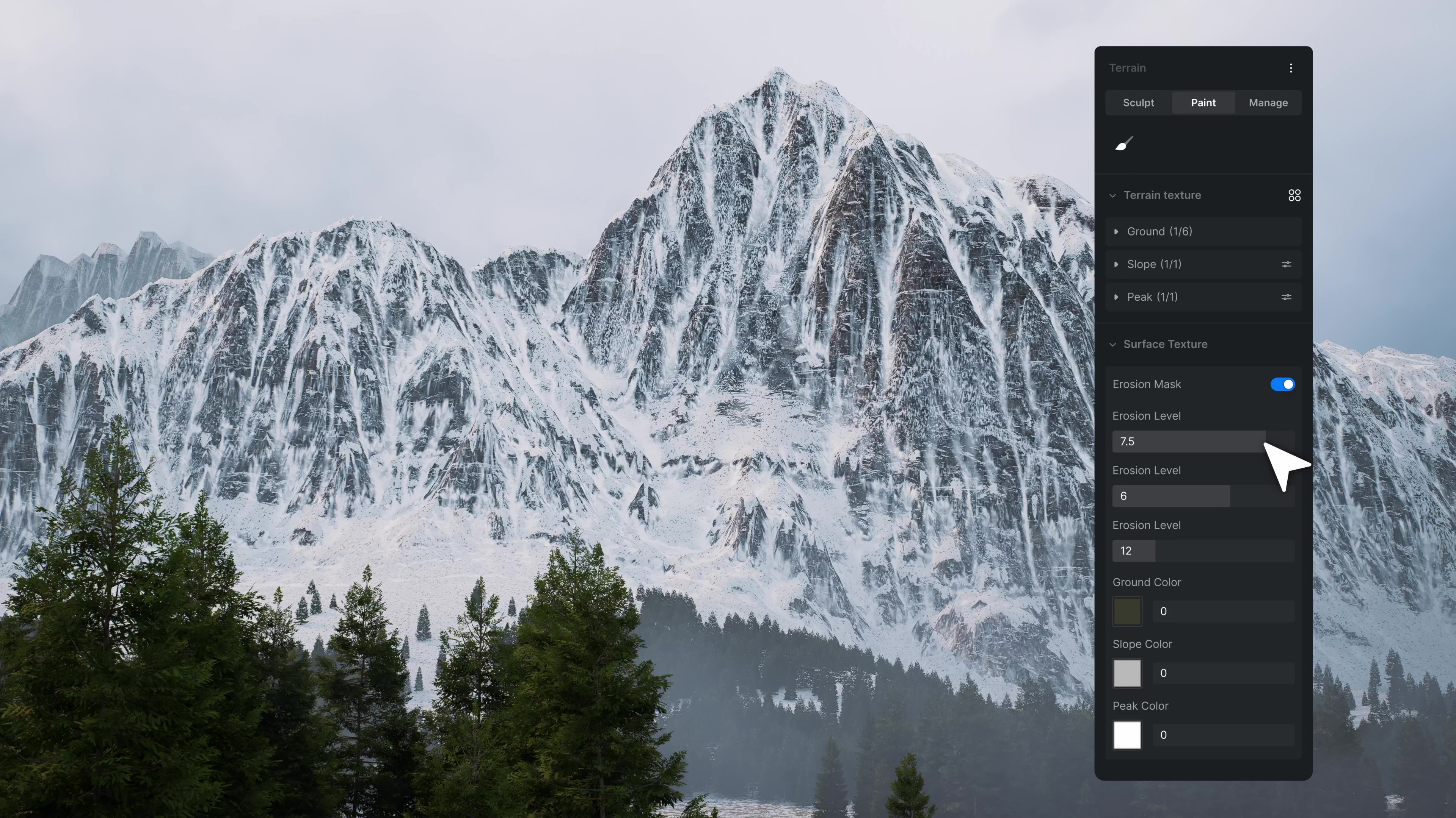
Optimized Erosion Layer
- Added Erosion Mask to Paint > Surface Texture for accurate control over the erosion effect and area.
- Supports automatically adapting the erosion layer to changed terrain heights.
-
Added Apply to Terrain to Heightmap Resources. Supports applying heightmap resources to the existing total terrain height.
-
Other optimizations:
- Added a live indicator of terrain heights during the sculpting process.
- Added a Rotate parameter to the Sculpt brush.
- Added a Rotate parameter to the slope material UV controller.
- Supports non-proportional scaling for heightmap * Supports offsetting imported heightmaps along the Z axis.
- Standardized the units of terrain to meters.
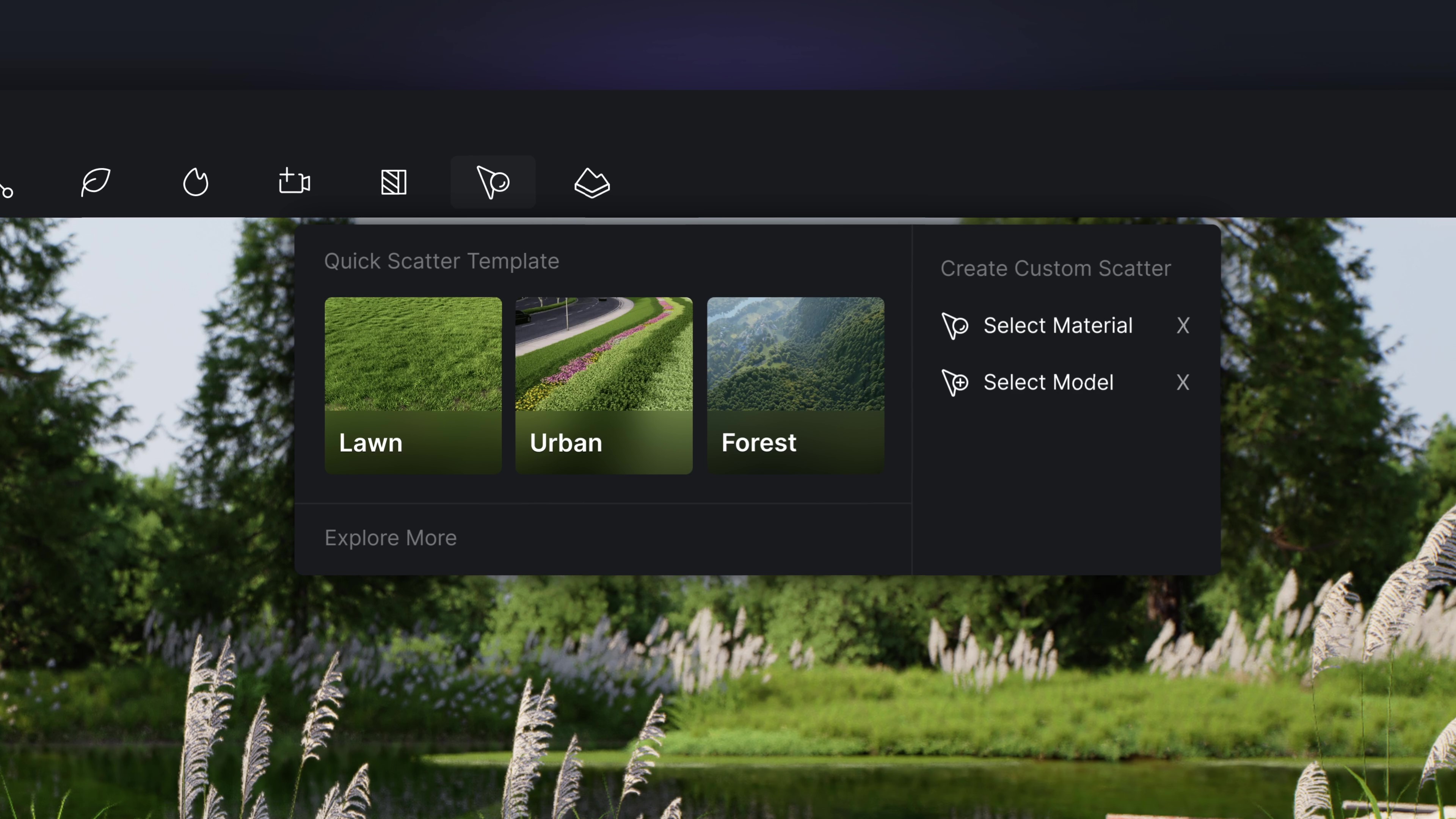
6. Optimized Scatter Workflow
-
Scatter Workflow Optimizations
-
Added Quick Scatter Template to Scatter on the top toolbar.
-
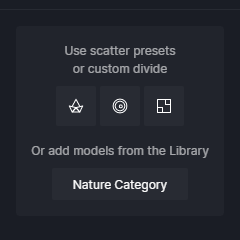
Added prompts to the right sidebar to guide the subsequent steps after creating a scatter surface.
- Use scatter presets or custom divide: Open presets from Scatter library/Studio or the custom scatter editing panel.
- Or add models from the Library: Open Nature Category
- Optimized interface for Scatter control panel, making it easier to use. Added Simplified Mode to the “More” menu.
-
-
Added Scatter Quality Option
- Added Scatter Quality to the “More” menu to help remove obvious jaggy edges of the scatter surface.
7. Optimized Direction Controller for Fly in/out Animation Templates
- Replaced the original XYZ direction controller with new settings for horizontal/vertical rotation degree.
8. Units for Model Position and Size
- Added Model Unit to Preference with options of millimeter, centimeter, meter, inch, and foot for model size and position display.
- Changed unit setting will immediately take effect, without having to restart D5 Render.
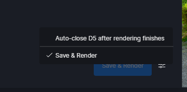
9. Auto-save of Render Queue before Cancelling Rendering
-
Added “Auto-close D5 after rendering finishes” and “Save & Render” to Render Queue.
- Auto-close D5 after rendering finishes: Check to enable the feature. D5 will automatically close after the rendering task is completed.
- Save & Render: Check to enable the feature. D5 will automatically save the current project file before starting rendering.
10. Batch Deletion in Scene List
- Supports pressing Ctrl or Shift key to batch select scenes. Right-click on any of the selected scenes and choose “Delete” to remove all selected scenes.
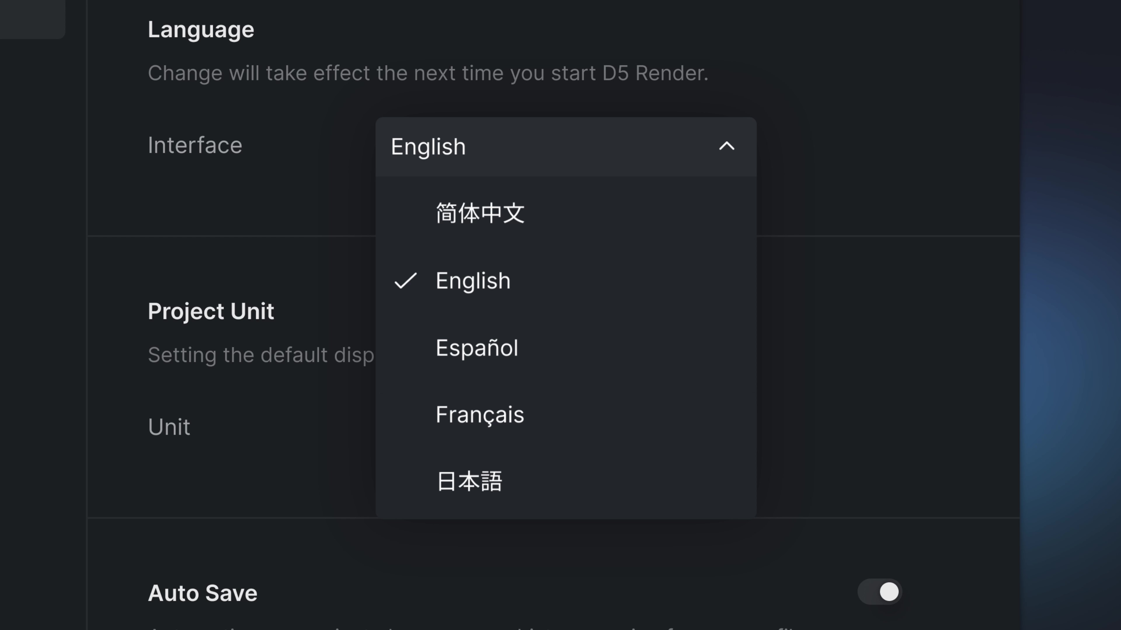
11. French and Japanese Language Interface
- Supports switching to French/Japanese language interface in Preference > Language, which will take effect after restarting D5 Render.
12. DLSS 4 Support
-
Supports DLSS 4 Frame Generation to enhance FPS by utilizing AI to generate extra frames.
-
Note: To enhance the real-time FPS by three or four times with DLSS 4, please prepare a GeForce RTX 50 series GPU and follow the steps as below:
- Close D5 Render: Ensure D5 Render is totally closed.
- Open installation directory: Right click on the D5 icon and select “Open File Location” to enter the installation directory.
- Locate to the DLSS 4 file: Navigate to D5 Render\Engine\Plugins\Runtime\Nvidia\Streamline\Binaries\ThirdParty\Win64\DLSS 4
- Duplicate all the files within the DLSS 4 file: Select all the files using shortcut keys Ctrl + A and copy them by pressing Ctrl + C.
- Paste files to target directory: Return to the parent folder D5 Render\Engine\Plugins\Runtime\Nvidia\Streamline\Binaries\ThirdParty\Win64, right click on a blank space to select “Paste,” and replace the existing files.
- Restart D5 Render: Start D5 Render and check if the 3x or 4x options can be enabled.
D5 for Teams
1. OneDrive and SharePoint Integration
- Supports connecting to OneDrive or SharePoint account from the D5 Client. Supports direct import of stored .skp/.3dm/.fbx/.abc/.d5a models to D5 and upload of D5 models to OneDrive or SharePoint.
Onedrive Integration | User Manual
Sharepoint Integration | User Manual
2. Team Brand Watermarks
-
Supports adding brand logo as watermarks on rendered images or videos.
-
Supports .jpg and .png pictures up to 20 MB.
Team Brand Watermarks | User Manual
3. Optimized 3D Dollhouse Animation
- Optimized 3D Dollhouse animation for virtual tour.
Assets
1. Hotel & Resort Assets
- Added hotel & resort assets including 240 models of waitstaff, individuals in business suit, and vacationers in bathrobes or swimsuits, alongside 137 decorative models for lobbies and various interior spaces.
2. New Scatter Templates
- Added 28 new scatter templates.